Work
I have been working as Professor of Geophysics at Universidade de São Paulo (USP), Brazil, since August 2023. I use tiny disturbances in the Earth’s gravity and magnetic fields to investigate the inner structure of the Earth and it’s evolution through time. These disturbances can be measured on the ground using specialized equipment, onboard dedicated satellites, and even in very small sections of rocks using magnetic microscopes. I also create new mathematical and computational methods for extracting as much information as we can from these datasets.
In more technical terms, my main specialities are:
- Potential field methods (the study of the Earth’s gravity and magnetic fields)
- Inverse problems (determining the Earth’s inner structure from surface observations)
- Research software engineering (building quality software for science)
I started working on these topics in 2008 during a research internship under Prof. Naomi Ussami during my time as an undergraduate student at USP, and have continued throughout graduate school at the Observatório Nacional with Prof. Valéria C. F. Barbosa and a postdoc with Prof. Paul Wessel at the University of Hawaiʻi at Mānoa.
Interested in my research or joining my lab? See the Computer-Oriented Geoscience Lab website.
Most of my career has revolved around the development of open-source software for geophysics, mainly Fatiando a Terra and PyGMT. These software underpin and shape all of my research and teaching. My approach to science in general is also heavily influenced by the open source and open science movements. All of the papers, code, figures, slides, and teaching resources I create are freely available under permissive open licences, like CC-BY and BSD.
Before my current position at USP, I was a Lecturer in Geophysics at the University of Liverpool, UK, Visiting Researcher at the University of Hawaiʻi at Mānoa, USA, and Professor of Geophysics at the Universidade do Estado do Rio de Janeiro, Brazil. I am and have been involved with several community-led organizations, like the Software Underground and EarthArXiv.
Need a photo?
If you need a photo of me for promotional material (for talks or interviews, for example), use this one. Feel free to crop it however you see fit.
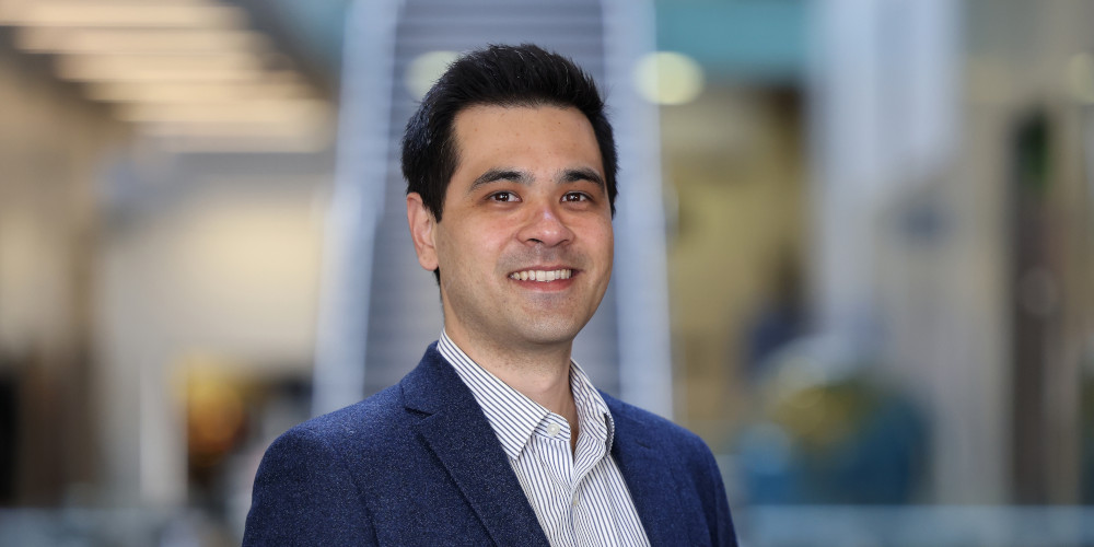
Photo of me taken in May 2025. You may use this photo under the terms of the CC-BY license.
Software
Here are some of the open-source software projects that I develop:
- Fatiando a Terra: Collection of Python libraries for Geophysics built by a community of geoscientists and software developers with a passion for well-designed tools and helping our peers. I’ve been working on Fatiando since around 2010 when I started my MSc. It’s been the main focus of my career and it permeates all aspects of my work, from research to teaching.
- PyGMT: The Generic Mapping Tools (GMT) is one of the most widely used open-source projects in the Earth Sciences. I had the pleasure to join the GMT team as a postdoc to create PyGMT. Lately, my contributions to GMT and PyGMT have been more on the community and guidance side. Thankfully, they don’t really need me for the coding parts anymore.
- Tesseroids: Command-line programs for modelling the gravitational attraction of spherical prisms (tesseroids). This was my first open-source project, which I started during my BSc dissertation project with Naomi Ussami and Carla Braitenberg. Through Tesseroids, I learned about documentation, unit tests, cross-compilation, version control, and more.
- Nēnē: A no-frills static site generator. It’s the side project that I use to blow off steam and experiment with new Python features. It’s also what I use to build this website. The name is a nod to the unforgettable time I spent in Hawai’i and Urubu, which I used to build my website before.
- xlandsat: A Python library for loading Landsat multi-spectral remote sensing data downloaded from USGS EarthExplorer. It started as code I wrote for my remote sensing class at Liverpool. It’s also what I used to make some pretty images of the 2022 Mauna Loa volcano eruption and some nice wallpapers.
Non-work interests
Here are some things I enjoy in my limited free time:
- Cooking for my family and friends
- Reading and watching sci-fi and fantasy
- Playing Incineroar in Super Smash Bros Ultimate
- Failing to finish Tears of the Kingdom
- Baking sourdough bread (my starter is from 2017 and has moved continents twice)
- Making noise with my ukulele and off-tune baritone
- Choir singing (I’m actually back in the same choir I sang in back in 2005-2007)
Personal
I was raised in Botucatu, a small town about 200 km from São Paulo, Brazil. Since then, I’ve lived in: Ithaca (USA), São Paulo (Brazil), Toronto (Canada), Rio de Janeiro (Brazil), Honolulu (Hawai’i/USA), and Liverpool (UK). Currently, I’m back in São Paulo.
My wife Carol is a biologist and science writer. After quite a few career shifts after her PhD, she now works with outreach and event organization at the Society for Experimental Biology. I’m very lucky that she puts up with me and was willing to go half-way around the world with me throughout this winding career path. We have a wonderful, smart, and strong-willed daughter. I couldn’t be prouder of both of them!
Both of my parents were zoology professors at UNESP, so I’ve been around academia from an early age. A large benefit from this is that I got to learn English in the USA during my parents postdoc at Cornell University. I now realize what an incredible advantage this was for me and I’m eternally grateful to my parents for the opportunity.
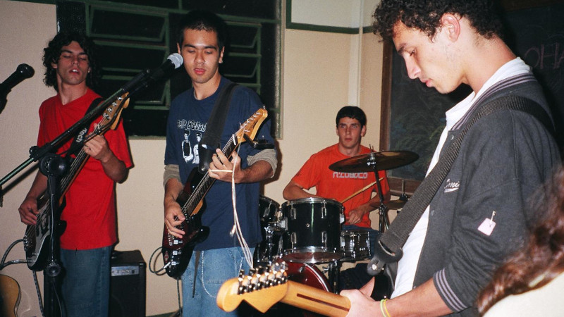
I was a bit of a nerdy kid. I had a Magic The Gathering phase and briefly had a table-top RPG group. I liked playing video games, bike riding, and playing with friends on the street. As a teenager, I had a punk rock phase (yes, that included a mohawk) and I was the lead singer in an indie rock band called Jeca Tatu. We weren’t very good but we had loads of fun playing mostly covers at local festivals and parties at our friends houses. I still enjoy playing games and music during my free time, only now I get to do it with my daughter!